
Services
Aerial Photography
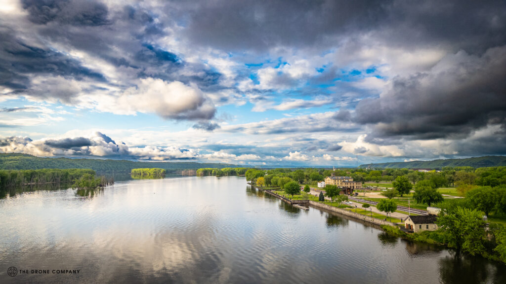
- Access to unique angles and perspectives: Drones can fly at a variety of altitudes and angles, allowing photographers to capture images that would be difficult or impossible to obtain from the ground.
- Increased safety: Using drones to capture aerial images eliminates the need for photographers to climb onto roofs or use other potentially dangerous methods to get the shots they need.
- Cost efficiency: Drones can often capture images more quickly and efficiently than traditional methods, reducing the overall cost of the project.
- Greater detail: With the ability to fly closer to objects, drones can capture more detailed images than those taken from a distance using traditional cameras.
- Versatility: Drones can be used to capture images in a variety of settings, including hard-to-reach locations and areas with difficult or dangerous terrain.
Construction site Progression

- Improved site surveys and mapping: Drones can be used to quickly and accurately survey construction sites, providing detailed maps and 3D models that can be used to plan and execute projects. This can save time and resources compared to traditional survey methods.
- Enhanced project monitoring and documentation: Drones can be used to regularly capture images and video of construction sites, providing a clear record of progress and enabling more efficient tracking of project milestones.
- Enhanced safety: Drones can be used to inspect and monitor hazardous construction sites, reducing the need for workers to be present in potentially dangerous areas.
- Cost savings: Drone mapping can ensure contractors and suppliers are delivering materials as ordered. Drones can be used to capture volumetric data on stockpiles, allowing managers to track changes over time and identify potential issues such as shrinkage or overloading.
- Improved communication and collaboration: Drones can be used to provide daily images and video of construction sites, enabling stakeholders to view progress in near real-time and facilitate better communication and collaboration.
roof & tower inspection
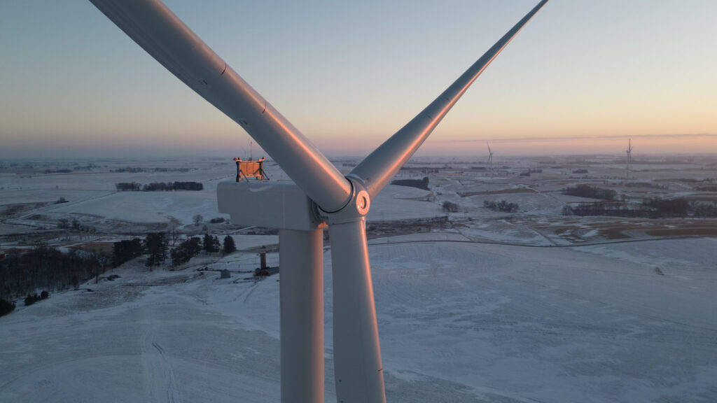
- Improved safety: Inspecting roofs and communication towers can be a dangerous task, particularly if they are located at a high altitude or in hard-to-reach areas. Drones can be used to safely inspect these structures, reducing the need for workers to be present in potentially hazardous areas.
- Enhanced inspection coverage: Drones can capture images and video of roofs and communication towers from a variety of angles and heights, providing a more comprehensive view of the structure and enabling more thorough inspections.
- Cost savings: Using drones can reduce the need for manual labor and equipment, leading to cost savings on labor and equipment.
- Improved documentation: Drones can capture high-resolution images and video of roofs and communication towers, providing a clear record of their condition and enabling more efficient tracking of maintenance and repair needs.
2d & 3D Mapping
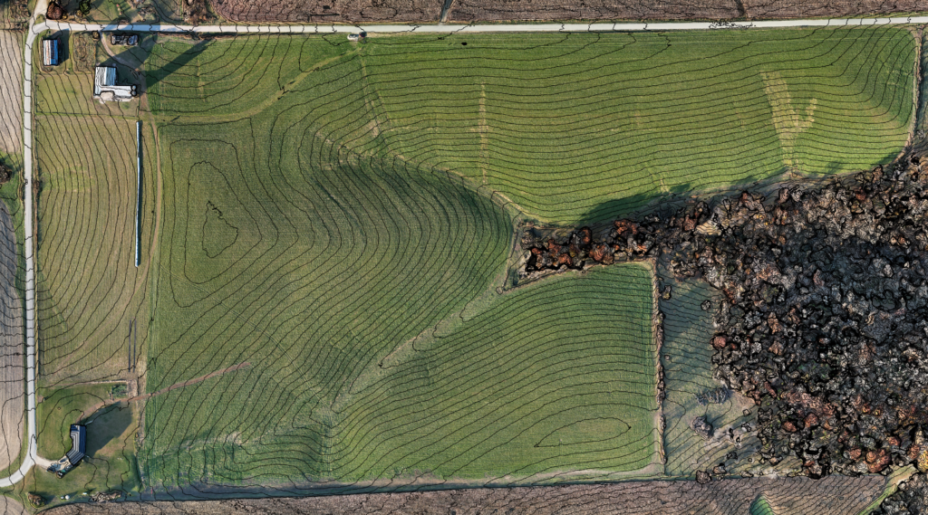
Drone based mapping has revolutionized the way property owners can survey and manage their land. Gone are the days of hiring a team of surveyors to manually map out every inch of your property. Instead, property owners can now use drones equipped with advanced mapping technology to quickly and accurately survey their land.
- Cost-effective: Hiring a team of surveyors to map out your property can be expensive. Drones, on the other hand, are a much more cost-effective option. They can cover large areas in a short amount of time, and the cost of the equipment and data processing is significantly lower than traditional survey methods.
- Increased accuracy: Drone based mapping uses high-resolution imagery and advanced GPS technology to create highly accurate maps of your property. This level of accuracy is not possible with manual survey methods, which can result in errors and inaccuracies.
- Faster data collection: Drones can cover large areas in a short amount of time, allowing property owners to quickly and efficiently collect data on their land. This can be particularly useful for large properties or those with difficult terrain.
- Enhanced safety: Traditional survey methods often require workers to access difficult or dangerous areas, such as steep slopes or bodies of water. Drones, on the other hand, can safely survey these areas without putting workers at risk.
- Improved decision making: Drone based mapping provides property owners with detailed, up-to-date information about their land. This can help them make informed decisions about how to use and manage their property, such as identifying areas for development or conservation.